As climate change continues to threaten both natural and built environments, the risk of impact to transportation infrastructure rises. Scientific studies predict that sea level rise will accelerate and, therefore, transportation infrastructure along the coast continues to be vulnerable to inundation.
The St. Lucie TPO’s Unified Planning Work Program (UPWP) initiated efforts to assess vulnerabilities of local transportation assets and services to extreme weather and other environmental conditions and for identifying ways to improve the climate adaptation/resiliency of the assets and services.
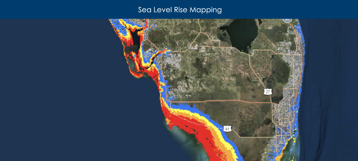
This document is a case study assessing local transportation system vulnerability to sea level rise by using Sea Level Scenario Sketch Planning Tool and the National Oceanic and Atmospheric Administration (NOAA) Coastal Flood Exposure Mapper. It is a selected scenario planning exercise and demonstration of geospatial hazard assessment tools.
